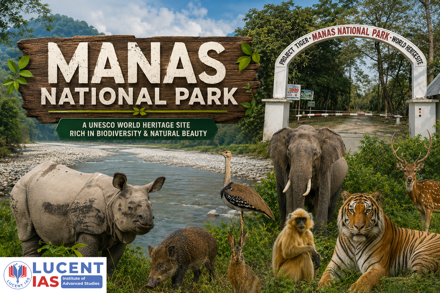
Explore Manas National Park in Assam—its UNESCO World Heritage status, unique biodiversity, endangered species, rhino recovery, rivers, and conservation achievements. Important for APSC ( Prelims & Mains ).
Manas National Park An Overview:
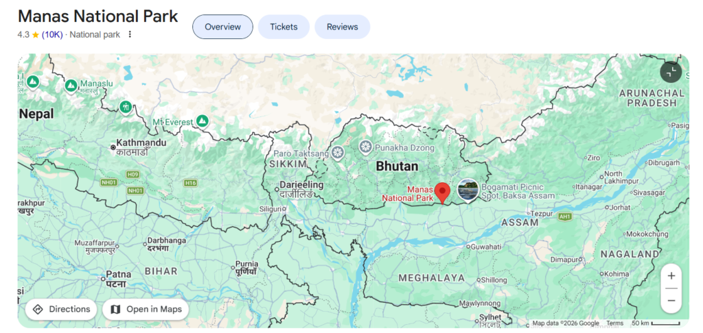
Manas National Park is an international transboundary landscape situated at the Himalayan foothills of Assam, directly contiguous with Bhutan’s Royal Manas National Park. Named after the Manas River, it transitions dynamically from the Bhutan hills into the flat, fertile alluvial plains of the Brahmaputra Valley.
- Location: Himalayan foothills of Assam, India (covering Baksa and Chirang districts). It forms a contiguous transboundary protected area network with Bhutan’s Royal Manas National Park.
- Geographical Features: Characterized by the Sub-Himalayan Bhabar-Terai formation, featuring porous boulders up north and fine alluvial grasslands down south.
- Key Hydrology: Drained by the transboundary Manas River and its major tributary, the Beki River.
- Joint Governance: Administered jointly by the Assam Forest Department and the Bodoland Territorial Council.
- Status: UNESCO World Heritage Site, Project Tiger Reserve, Biosphere Reserve, and Elephant Reserve.
- Terrain: Characterized by a classic Bhabar-Terai ecosystem, featuring porous alluvial terraces, boulder-strewn foothill streams, tall elephant grasslands, and subtropical moist deciduous forests.
Administrative & Safari Ranges
- Western Range: Stationed at Panbari.
- Central Range: Stationed at Bansbari (near Barpeta Road; serves as the primary tourist hub and gateway to the Mathanguri forest lodge on the Bhutan border).
- Eastern Range: Stationed at Bhuyanpara (near Pathsala).
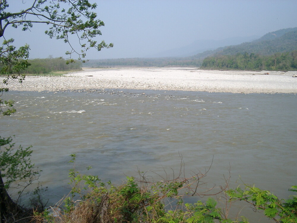
The River System & Hydrological Network of Manas National Park
- Manas River: The primary perennial river that flows directly through the heart of the national park from north to south after descending from the gorges of Bhutan. It serves as a major zoo-geographic barrier (e.g., isolating the golden langur to its western bank).
- The Mathanguri Bifurcation: At Mathanguri (the entry point where the river enters the plains from the Bhutan hills), the main channel splits into distinct channels:
- Beki River (Kuri Chhu): The major eastern branch. In recent years, due to heavy monsoon siltation upstream, nearly 80% of the main river’s water discharge has diverted into the Beki channel.
- Manas (Western Branch): The main western channel.
- Aie River: Flows through the western buffer zones of the reserve, contributing significantly to the alluvial deposits.
- Other Smaller Tributaries & Streams: The park is crisscrossed by several seasonal and perennial foothill streams, including the Pagladia (drainage basin impact), Hakua, Bigoni, and Mora Manah.
Regulatory Designations & Timeline of Manas National Park
- 1928: Notified as a Wildlife Sanctuary covering an area of 360 km².
- 1973: Designated as one of India’s first Project Tiger Reserves and also recognized as a Biosphere Reserve.
- 1985: Inscribed as a UNESCO Natural World Heritage Site.
- 1989/1990: Granted official National Park status after incorporating the Kahitama, Kokilabari, and Panbari Reserve Forests.
- 2003: Declared a core component of the Chirang-Ripu Elephant Reserve.
- Global Bird Status: Recognized as an Important Bird and Biodiversity Area (IBBA) by BirdLifeInternational.
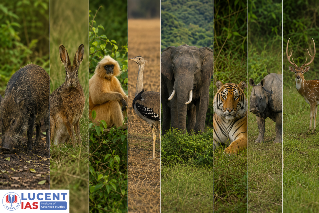
Critically Endangered Endemic Wildlife
- Pygmy Hog (Porculasalvania) – World’s only remaining wild population.
- Hispid Hare (Caprolagushispidus)
- Golden Langur (Trachypithecus geei)
- Bengal Florican – Hosts the world’s largest population of this endangered bird.
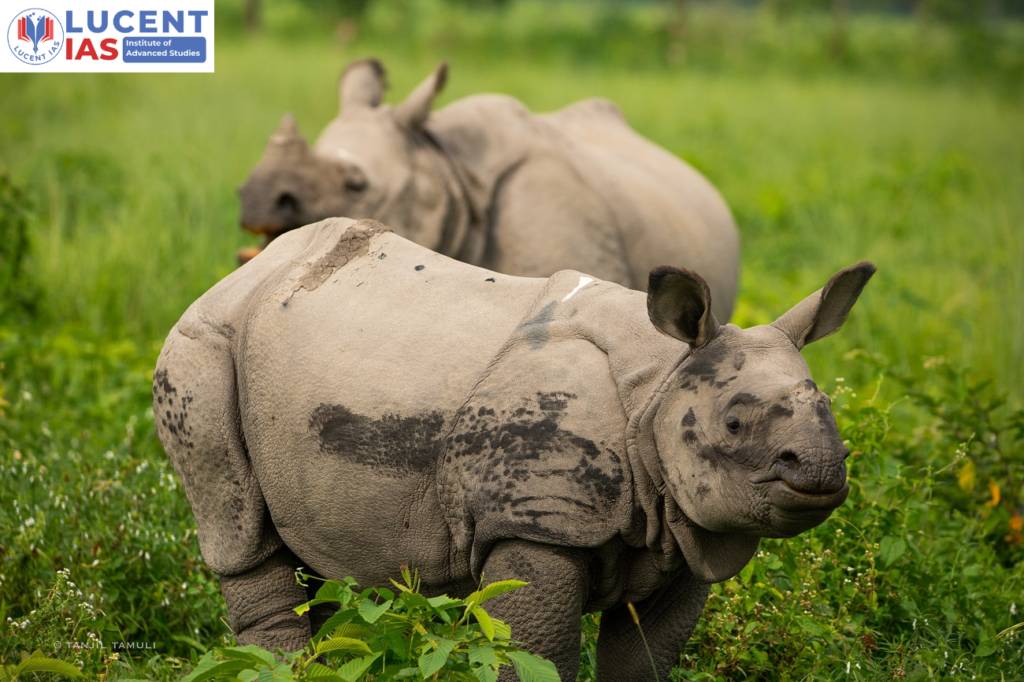
UNESCO “In Danger” Listing & Rhino Recovery in Manas National Park
- 1992 – Crisis: Ethnopolitical unrest and rampant poaching in the 1990s caused the local extinction of the Indian One-Horned Rhinoceros, leading UNESCO to list Manas as a World Heritage Site in Danger.
- 2007-2011 – Recovery: A major conservation initiative reintroduced 32 rhinos into the park, helping restore stability and wildlife protection.
- 2011: UNESCO removed the “In Danger” status following successful conservation efforts.
- 2026: The rhino population in Manas has recovered to 54 wild rhinos.
About Lucent IAS
Lucent IAS is a premier coaching institute in Guwahati, dedicated to empowering APSC aspirants with a result-oriented approach. Recognized as a top destination for APSC Coaching, we offer comprehensive guidance ranging from Foundation Courses and Advanced Mains preparation to our signature Assam-Centric study modules. With expert faculty, small batch sizes for personalized mentoring, and the acclaimed Saadhana Test Series, Lucent IAS is committed to helping you crack the Civil Services Examination.
Publications From LUCENT IAS
- “The Assam Odyssey: The Complete Assam Centric Resource useful for APSC CCE and various other Departmental Examinations. Read More
- InExam PYQ Explained.Read More
- Mains Tattva: The Craft of Answer Writing (GS Paper PYQs). Read More
- Maanchitra – An Illustrative Colour-Coded Informative Map of Assam. Read More
- প্ৰাৰম্ভ (Prarambha). Read More
- অসম ওডিচী – The Assam Odyssey (Assamese Edition). Read More
Start your journey to success today. Visit us at lucentias.com or call +91-6913007777 for more details.